Released product · Web, iPhone, iPad and Android
ClearCraft Geoportal:
from map to web and mobile.
A free map of land parcels in Poland, available in the browser, on the App Store for iPhone and iPad, and on Google Play for Android. I took the product from reusable map components through public data integrations, a mobile interface, automated checks and store release. This is the engineering story behind the application you can use today.


Released on the web and App Store in October 2026. The public App Store release is 1.0.3. Also available on Google Play for Android. The interface is in Polish; maps cover Poland and need an internet connection.
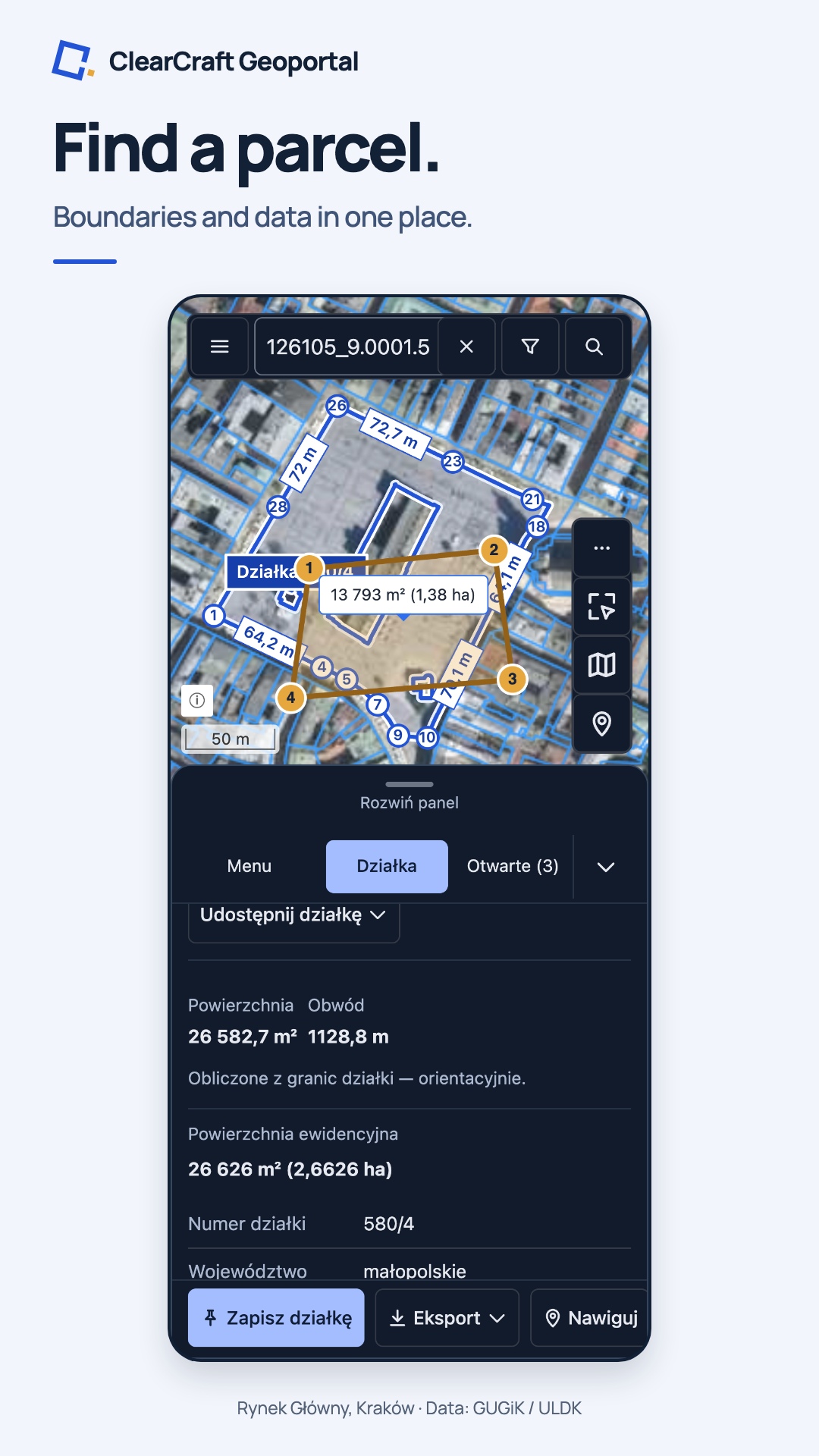
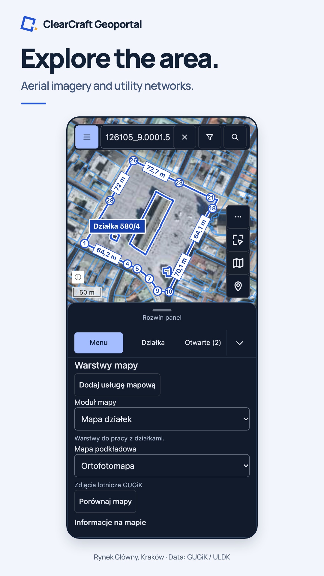
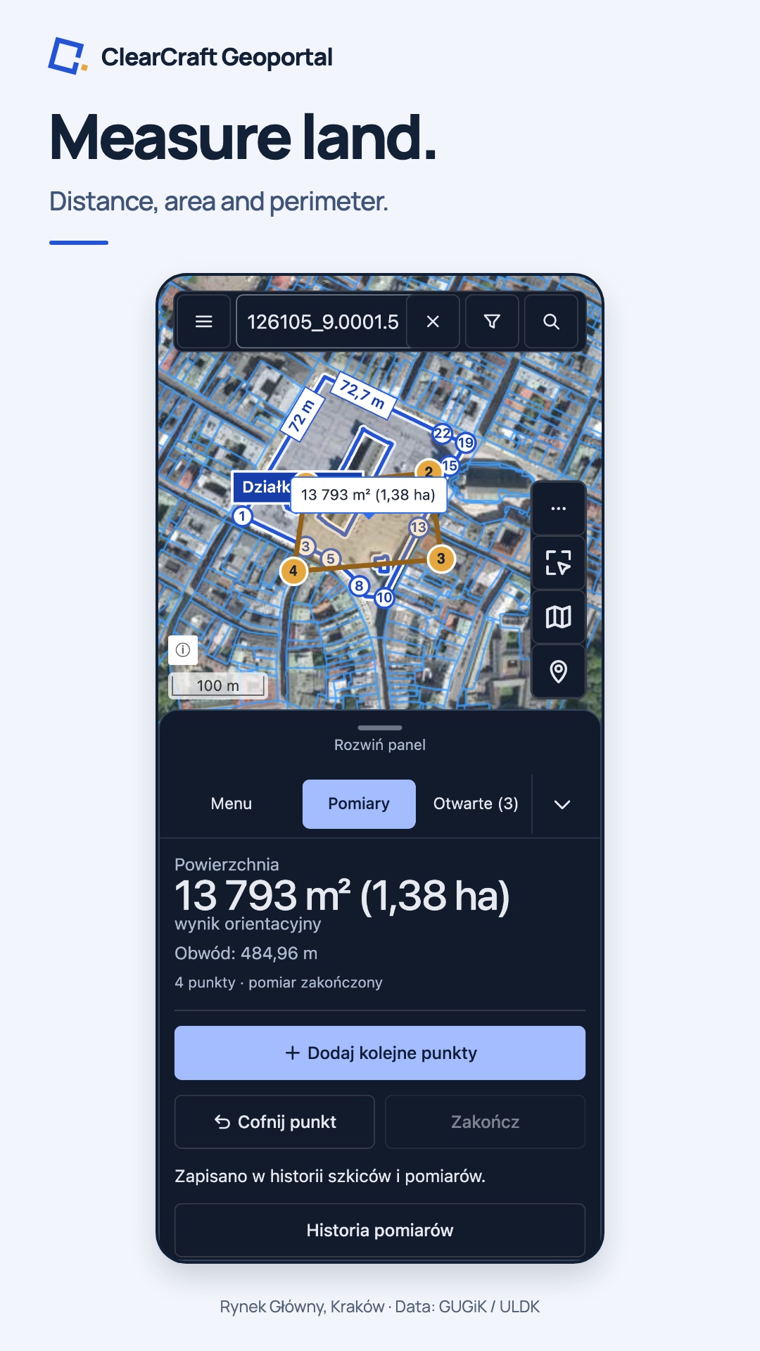
Actual browser views at a phone viewport. Rynek Główny, Kraków; 3 November 2026. Data: GUGiK / ULDK. Measurements are approximate.
- User task
- Find a parcel, check the available information and save its parcel card.
- My contribution
- Product scope, Angular architecture, map integrations, native delivery, testing and release.
- Working evidence
- A public web application and apps available on the App Store and Google Play.
The product
A clear task.
A focused first release.
Users can search by parcel or address, select a parcel on the map, inspect available registry and planning information, switch map layers, measure distance or area, and save the parcel information as TXT or PDF. The application needs no account and contains no ads.
The phone interface keeps more of the map visible with compact panels, measurements on the tools palette and a shortcut back to the selected parcel. Address results mark the searched location; explicit finish and undo controls make touch measurements easier to complete.
Data comes from public services, including GUGiK and Geoportal. Coverage and freshness depend on those providers. ClearCraft Geoportal is independent of the authorities; its data and measurements are informational.
Web and Android release 1.1
The 1.1 toolkit
on web and Android.
This 1.1 feature list describes the web application and the Google Play release. The public App Store release is 1.0.3; this list is not a guarantee that every feature is available in that iOS release.
- Parcels and personal data: find the parcel at the device location, keep saved parcels with names and notes, import a TXT or CSV list of parcel identifiers, and manage saved points, areas and GPS recordings. Parcel-list backups and geometry exports stay under the user's control.
- The map and its surroundings: follow the device location in the foreground, use an overview map, inspect feature information and manage layers. Basemaps, legends, opacity, orthophoto comparison and user-added map services are included.
- Sketches and measurements: draw or enter coordinates, style and label geometry, keep a sketch history, and import or export GeoJSON, KML, GPX, GeoPackage and zipped Shapefile. Measure distance, area, perimeter and segment lengths. Personal-data exports support GeoJSON, KML and GPX.
- Sharing: share a map view or its layer settings, a parcel or a point using a link or QR code. System sharing is available where supported by the device.
Search and parcel cards connect these tools: registry data, addresses, available local and general plans with sources, calculated area and perimeter, boundary labels on the map, PDF/TXT export, printing and directions in an external map application. Settings, Help, release notes, accessibility information and a feedback form complete the public interface.
These are the free public features. The extended parcel report is being prepared as a separate Premium feature and is not available in this release. The interface is Polish; measurements are approximate and provider coverage varies.
Architecture
Shared map logic.
Product rules at the edge.
Angular owns the interface and application state. OpenLayers handles map rendering and interactions. Reusable map, geometry and service behaviour lives in a local library; the application composes it with Polish parcel identifiers, data sources and user-facing explanations. Nx keeps the projects and dependency boundaries explicit.
The same web interface runs in a browser and in a Capacitor shell. Native adapters handle the platform boundaries, including location, document output and sharing. Mobile work includes safe areas, keyboard changes, rotation and how panels affect the usable map.
Public data adapters handle provider-specific responses and errors. Layer controls explain scale limits; exported parcel cards retain source references. Failed tiles can retry independently.
Verification
Test the task,
then the device.
- Deterministic checks: unit and browser tests exercise state, adapters and rendering; parcel fixtures isolate regressions from upstream service outages.
- User journeys: Playwright covers search, parcel details, layers, measurements and parcel-card output, including mobile layouts and automated accessibility checks.
- Native checks: simulator and emulator flows, with earlier physical iPhone checks, cover document sharing, print preview, location, measurements, returning from the background and offline startup. TestFlight distributes signed candidates for device testing.
- Publication checks: production builds, permitted assets, public links, privacy information, source attribution and performance measurements are verified separately.
These checks cover recorded scenarios; they do not establish that every device, public dataset or service response has been tested. Live provider checks supplement the controlled fixtures.
Delivery
Faster fixes.
Controlled releases.
I built a delivery workflow that separates interface fixes from native releases. GitLab CI verifies the frontend and prepares a versioned, signed package. Publication is a deliberate step, with a release history and a way to restore an earlier package.
The iPhone and iPad app starts from local files. Compatible packages download in the background and take effect on the next full launch, without reloading an open map. Signatures and integrity checks protect the download; a failed startup falls back to the bundled interface. Map data and searches still need an internet connection.
This lets me deliver eligible interface fixes without rebuilding the native app each time. Native integrations, permissions and substantial feature changes follow the App Store release process. The browser has its own deployment and update lifecycle, using the same Angular interface.
Open the product website · View the App Store listing · View the Google Play listing
Need this kind of ownership on your team?
I work on Angular architecture, integrations and delivery, from a defined task to a verified release.
contact@clearcraft.dev ↗Apple, the Apple logo, iPhone, iPad and App Store are trademarks of Apple Inc., registered in the U.S. and other countries. Google Play and the Google Play logo are trademarks of Google LLC.